Biggar Parish
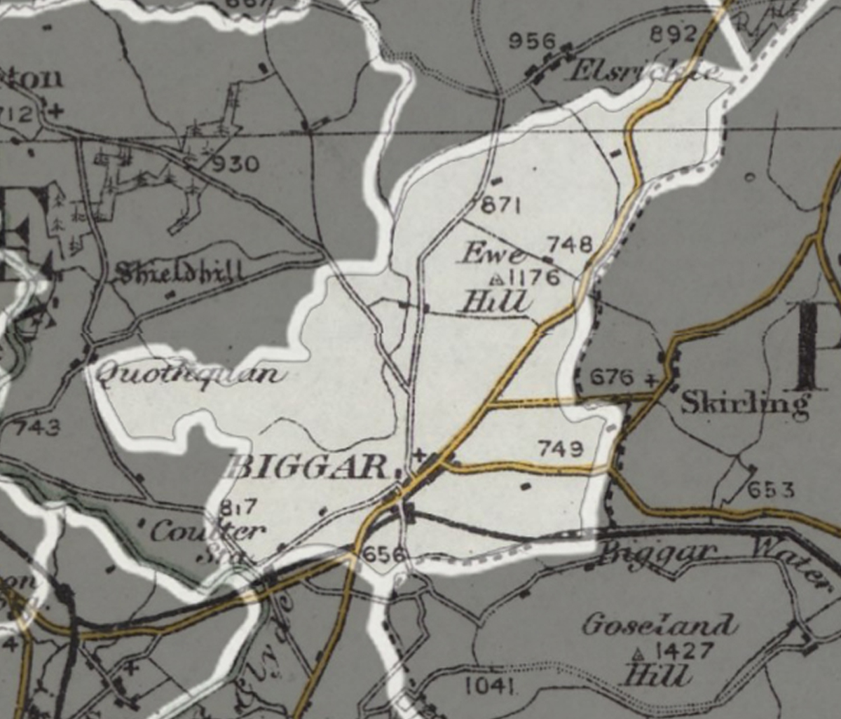
A parish extending over 7,272 acres, including the town of Biggar, and village of Candy Mill.
Read the description of parish in 1882...
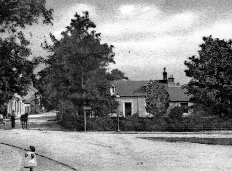
BIGGAR, rivulet of Lanarkshire and Peeblesshire, and town and parish on south-east border of Lanarkshire.
The rivulet runs about 4 miles southward, and 5 miles eastward to the Tweed, at 8½ miles south-west of Peebles.—The town stands on the rivulet, 15¾ miles west-south-west of Peebles; consists of 2 parts, ancient and modern; was the scene of a battle between Sir William Wallace and the English and has a head post office with all departments, a railway station, 3 banking offices, 3 chief inns, a large ancient moat, a good bridge of 1873, a cruciform parochial church of 1545, a handsome United Presbyterian church of 1878, and 3 public schools with about 343 scholars. Pop. 1556.
The parish is 6½ miles long, and comprises 7272 acres. Real property in 1880-81, £14,445. Pop. 2128. The surface is partly hilly, and partly portion of a dingle extending from the Clyde to the Tweed. The seats are Biggar Park, Cambus-Wallace, Edmonston, and Carwood.
The Gazetteer of Scotland, by Rev John Wilson, 1882.
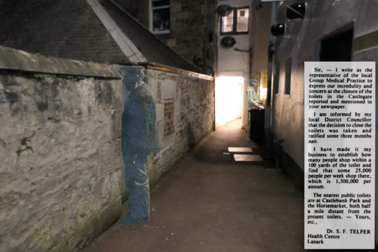
The Extinction of the Public Convenience
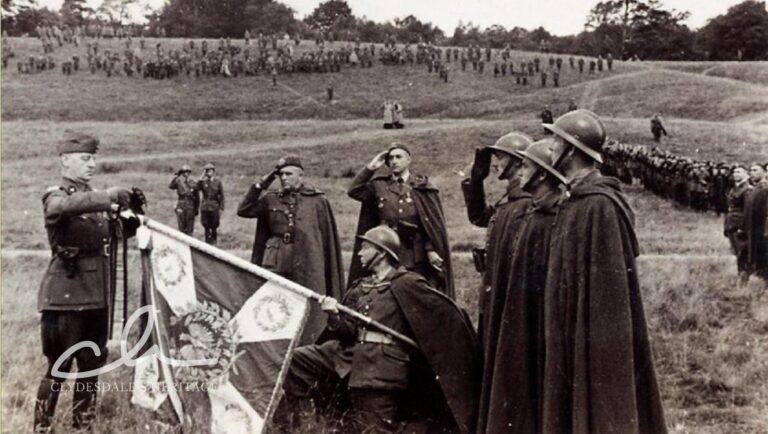
The Poles in Clydesdale During World War II – a story of courage